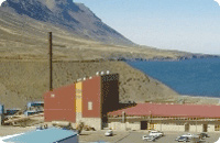
No clear or present danger from natural threats is present in Skagafjörður. At this point we have collected data on known natural threats in Iceland; that is earthquakes, volcanic activity, floods, storms, avalanches and earth slides.
Earthquakes and volcanic activity
Iceland is an island on the North Atlantic ridge, a divergent tectonic plate boundary that separates the Eurasian plate and North American plate. Seismic activity is thus quite common in Iceland, but as the plates are drifting apart from each other, the activity is not nearly as severe as in areas where transform or convergent boundaries occur. Volcanic activity in Iceland is mainly in the Icelandic highlands.
The location of Skagafjörður is outside the main seismic activity area of Iceland. Although there is no danger from volcanic activity or earthquakes originated in the area, some earthquakes that origin in other parts of Iceland, may be felt in the area, without being damaging to property or infrastructure. North of Skagafjörður is known seismic active area, capable of producing earthquakes up to 7.0 Richter scale. Activity there has not impacted or damaged properties or infrastructure. The latest notable activity in the area was an earthquake at 6.2 Richter scale originated about 140Km north of Sauðárkrókur in 1976 and an earthquake at 7.0 Richter scale originated about 50 Km north of Sauðárkrókur in 1963 . Both earthquakes were noted in Skagafjörður but neither of those did any damage to structures in Skagafjörður.
Floods
Although standing by the seaside, there has been no incident where sea has flooded Sauðárkrókur. One glacial river runs through Skagafjörður pronged in two channels near the source. This river is known for its spring floods, but those do not threaten property or inhabited areas in the region.
Storms and Hurricanes
Windy would be the right term to describe the weather in Skagafjörður. This is mainly due to the local sea breeze that occurs during warm days. South western storms can impact the area with constant wind strengths up to 28 m/s (62.5 miles/hour) and up to 50m/s in squalls. There have been reports of minor damages in Sauðárkrókur in the last 20 years due to flying debris in storms.
Avalanches and earth slides
All towns and villages in Skagafjörður are outside areas that can be considered in risk for avalanches. Transport networks as roads, airport and harbors are as well in no danger of avalanches.
No present danger of earth slides is at planned industrial areas in Skagafjörður. In 2007 a mudslide in Sauðárkrókur covered partly few houses and streets. This slide was coursed by a malfunction in a small power plant in town, leading to a rupture of a water pipe that supplied the generators. This incident was a unique occurrence and the power plant is now closed.
Light industry
The infrastructure in Skagafjörður is well developed and ready to welcome new businesses.


